St. Croix Total Maximum Daily Load (TMDL)
A framework for water quality improvement
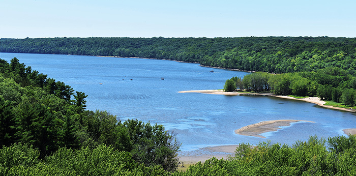
The St. Croix River and Lake St. Croix are highly valued resources that provide exceptional recreational opportunities and support a diverse ecology of aquatic and terrestrial species. Over the years, eutrophication, or nutrient enrichment, has occurred in Lake St. Croix due to excess phosphorus loading. In response, the DNR partnered with the Minnesota Pollution Control Agency and the St. Croix River Water Resources Planning Team to develop a Total Maximum Daily Load (TMDL). In 2012, the U.S. EPA approved the Lake St. Croix TMDL, calling for a 38% reduction in the human-caused phosphorus carried to the rivers and streams of the basin.
About the Basin
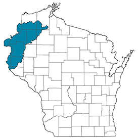
The St. Croix River basin is approximately 7,760 square miles, located in northwestern Wisconsin and Minnesota. The St. Croix River begins near Solon Springs, Wisconsin, flowing west and south more than 160 miles until it joins the Mississippi River at Prescott, Wisconsin. Lake St. Croix is a naturally impounded riverine lake in the lower 25 miles of the St. Croix River. The basin is predominated by forests in the north, and agriculture and grassland in the south. Agricultural land mainly consists of cash grain, continuous corn, dairy and potato/vegetable.
TMDL Implementation
The overall goal of TMDL implementation is to meet water quality standards and provide meaningful water quality improvements for Lake St. Croix by reducing the annual total phosphorus loading in the St. Croix River basin by 100 metric tons. In order to reach this goal, partners in both Wisconsin and Minnesota are working together to establish best management practices across the basin. Annual progress reports detailing this continuing effort can be found below.
Point Source Discharges
There are 52 wastewater facilities located in Wisconsin and Minnesota that discharge to surface waters in the St. Croix River basin. Through compliance with the National Pollutant Discharge Elimination System (NPDES) program, all permitted facilities are discharging at or below their TMDL wasteload allocations.
Municipal Separate Storm Sewer Systems (MS4s)
There are 29 regulated MS4 permittees in the St. Croix River basin, with 25 located in Minnesota and 4 located in Wisconsin. Of the four permitted MS4s in Wisconsin, two are meeting their wasteload allocations while the other two are finalizing their implementation plans. In 2019, Minnesota added four new regulated MS4s within the TMDL project area. The Minnesota Pollution Control Agency is currently making adjustments to stormwater wasteload allocations; however, these adjustments will not change the approved overall total loading capacity of the TMDL.
Agriculture
There are three Farmer-Led Watershed Councils in the St. Croix River basin: Horse Creek Watershed (Polk County), Dry Run Creek Watershed (St. Croix County) and the South Kinnickinnic Watershed (Pierce County).
Monitoring
- Water Quality of the St. Croix River, Metropolitan Council
- Assessing Lake St. Croix in 2018 on the Way to 2020 TMDL Goals, Science Museum of Minnesota
TMDL Resources
- Lake St. Croix TMDL Final Report
- Lake St. Croix TMDL Implementation Plan
- Updated Strategic Plan
- DNR's Nutrient Reduction Strategy Report
- Minnesota Pollution Control Agency - Lake St. Croix TMDL


