Wolf River Bottoms Wildlife Area - Herb Behnke Unit

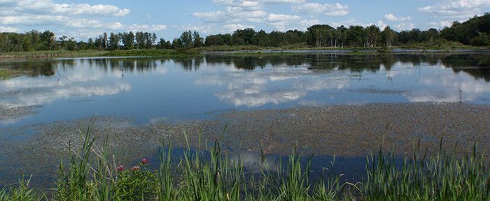
Wolf River Bottoms Wildlife Area-Herb Behnke Unit is found in northwest Outagamie County in the townships of Deer Creek and Maine and is approximately 2,500 acres in size.
The wildlife area is made up of sandy, forested ridges, multiple impoundments, spruce plantation, swamp hardwood, wetland and grassland habitat. Of the 2,500 acres of property, 1,800 acres are impounded, 200 acres are in upland timber, 100 acres are in grassland and the remaining acreage is in wetland habitat. Two-thirds of the property is within the Wolf River fringe floodplain limiting improvements that can be made.
Find Wolf River Bottoms Wildlife Area- Herb Behnke Unit 5 miles north of Shiocton on Highway M. There are three parking areas for the area. Two are located on the West side of County Highway M and the other is at the end of Balsam Road. Additional walk-in access can be reached on the north end of the property using Carpenter Road.
Management Objectives
The Herb Behnke Unit of the Wolf River Bottoms Wildlife Area — named for the late Herb Behnke, a long-serving Natural Resources Board member — is managed to provide opportunities for public hunting, trapping and other outdoor recreation while protecting the qualities of the unique native communities and associated species found on the property. Impoundments are managed to replicate natural disturbances in emergent marsh systems and to provide an interspersion of vegetation and open water. Shrub-carr habitat is maintained through mowing and prescribed fire in areas that do not have high potential for sedge meadow management. Where feasible, populations of invasive species are controlled or eliminated by cutting, pulling, burning, herbicide treatment and/or bio-control.
For more information on master planning for this and other wildlife areas around the state, visit the property planning page.
Recreation
-
The Wolf River Bottoms Wildlife Area-Herb Behnke Unit offers many recreational opportunities.
- Birding;
- Cross-country skiing (no designated trail);
- Hiking (no designated trail);
- Hunting;
- Trapping;
- Wild edibles/gathering; and
- Wildlife viewing.
Maps
Download [PDF] a map of this property.
If you are interested in exploring this property further, you can access an interactive map.
Find out more about how to adopt this wildlife area.

