Lake Pepin Wildlife Area
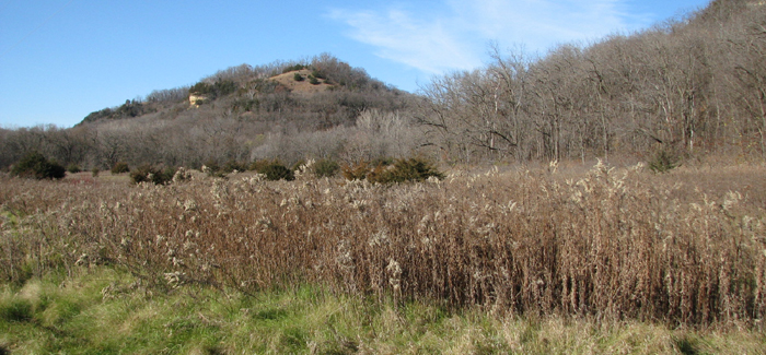
Lake Pepin Wildlife Area is located on State Highway 35, immediately south of the Village of Stockholm, and 3 miles north/northwest of Pepin. The land was originally purchased in 1969-1970 for the purpose of developing a state park along Lake Pepin. The state park was never developed and eventually reverted to state wildlife area. Prior to state ownership, this property was used primarily for recreation, agriculture and forestry.
State Highway 35 is situated at the base of the bluffs overlooking Lake Pepin on the Mississippi River and serves as a dividing line between habitat types on the property. The portion of the wildlife area that lies between the highway and Lake Pepin consists of a mix of bottomland hardwood tree species and brush. As you cross Highway 35 to the north, the vegetation transitions to mostly central hardwoods such as red oak, white oak and black walnut. Roughly 60 acres on the north side of Highway 35 is extrememly steep and inaccessible.
Exceptional presence of mature black walnut exists on the property as well as spectacular views of Lake Pepin from atop the bluffs.
Management Objectives
The primary objective of the wildlife area is to be managed for wildlife habitat and maintain a unique parcel of state land along Lake Pepin with diverse flora and fauna. Timber management techniques are used to protect the sensitive bluff land ecosystem while also maintaining a diversity of age classes in the forest cover types present.
For more information on master planning for this and other wildlife areas around the state, visit the property planning page.
Recreation
-
The Lake Pepin Wildlife Area offers many recreational opportunities:
- Birding;
- Fishing;
- Hunting (deer, turkeys, waterfowl and small game);
- Trapping;
- Wild edibles/gathering; and
- Wildlife viewing.
Maps
Download [PDF] a map of this property.
If you are interested in exploring this property further, you can access an interactive map.
Find out more about how to adopt this wildlife area.


