Western Prairie Habitat Restoration Area
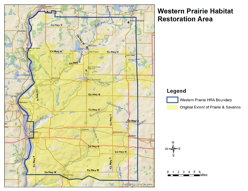
The large, landscape scope of the project is based upon comprehensive research of biodiversity and ecosystem management practices. Restoration of viable grasslands and wetlands to provide habitat for waterfowl, pheasants and grassland birds is the primary objective of the WPHRA project. Additional objectives include the preservation of public open space and recreational opportunities as well as improved water quality. The intent is to widely scatter suitable habitat throughout the area in a checkerboard pattern, combining working farms with prairie, savanna and wetlands.
- Property history
-
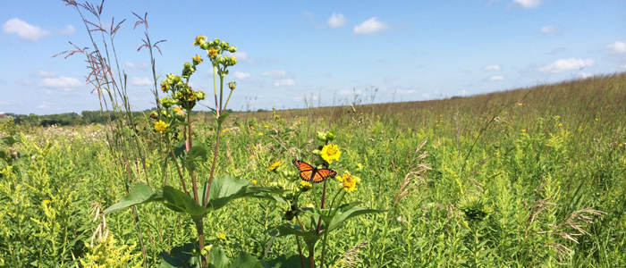
At the time of settlement by European immigrants in the mid-1800s, significant portions of western Wisconsin were covered by expanses of open grassland. The land was called "prairie" by early French settlers who could think of no other way to describe it than the word they used for "meadow". This area of Polk and St. Croix counties once had nearly 200,000 acres of tall grass prairie and oak savanna that were dotted with rich wetlands. Wildlife was abundant. In fact, many of the first visitors to the area reported great numbers of bison, elk and wild fowl.
In addition to the large expanse of native grasslands, nearly 140,000 acres were covered by oak brush, oak forest and aspen. Since all of these vegetative communities depend on periodic disturbance, it is likely that wildfires were a frequent occurrence on the landscape. It is also likely that the actual prairie and savanna acreage fluctuated over time depending on the distribution, frequency and intensity of wildfires.
The project area includes prairie remnants from one of the largest prairies found in the state along with a mix of grasslands, potholes and marshes that are extremely conducive to pheasant and waterfowl production. Natural woodlands within the area are comprised primarily of oak/hickory, southern mesic hardwood and aspen. Some of these forests are likely former oak savanna or prairie that were allowed to fill in with trees once fire was no longer a frequent occurrence. Reductions in habitat quality and quantity because of land use changes have contributed to the decline of grassland nesting wildlife populations. In addition, wetland loss or degradation has been an important factor in the decline of many wetland wildlife species. Ten species of birds known to occur in this area are state-listed as endangered or threatened and 19 species are listed as special concern. The area also includes 54 rare plant species, 18 of which are state-listed endangered or threatened.
The Western Prairie is a Land Legacy Place [PDF].
- Recreation
-
The following recreational opportunities exist at Western Prairie Habitat Restoration Area:
- birding;
- cross-country skiing (no designated trail);
- Snowshoeing
- hiking (no designated trail);
- hunting;
- trapping;
- wild edibles/gathering; and
- wildlife viewing.
- Property maps
-
St. Croix County Western Prairie Habitat Restoration Area properties:
- Star Prairie Seed Nursery [PDF] and aerial [PDF]
- Rush River Wildlife Area [PDF] and aerial [PDF]
- Sette Tract [PDF] and aerial [PDF]
- Ulrich, McAdams, & Goose Pond Tracts [PDF] and aerial [PDF]
- Schmitt Tract [PDF] and aerial [PDF]
- Johnson West Tract [PDF] and aerial [PDF]
- Johnson East Tract [PDF] and aerial [PDF]
- Nagel Wildlife Area [PDF] and aerial [PDF]
- St Croix Islands Wildlife Area [PDF] and aerial [PDF]
- Casey Lake Wildlife Area [PDF] and aerial [PDF]
- Oakridge Wildlife Area [PDF] and aerial [PDF]
- Ten Mile Creek Wildlife Area [PDF] and aerial [PDF]
- Willow River Wildlife Area [PDF] and aerial [PDF]
- Lundy Pond Wildlife Area [PDF] and aerial [PDF]
- Head waters of the Kinnickinnic Fish and Wildlife Area [PDF] and aerial [PDF]
- US Fish and Wildlife Service St. Croix Wetland Management District [exit DNR]
State Natural Areas within the Western Prairie Habitat Restoration Area project boundary:
Polk County Western Prairie Habitat Restoration Area properties:
- Parker Creek Wildlife Area [PDF] and aerial [PDF]
- Elkin Tract [PDF] and aerial [PDF]
- Spring Meadows Unit [PDF] and aerial [PDF]
If you are interested in exploring this property further or want to print other aerial photos or topographic maps, you can access an interactive map. Then go to the button in the upper left-hand corner called Layers and explore from there.
- Useful links


