Clam River Fishery Area
DNR Fisheries Areas
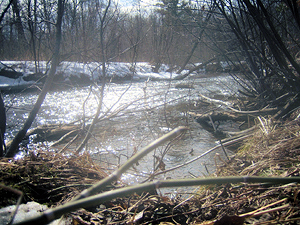
The Clam River is an excellent trout stream of northwestern Wisconsin. The North Fork of the Clam River originates as a small, intermittent stream in Washburn County. It rapidly enlarges in size as it is fed by a number of trout streams including Krantz Creek, the South Fork of the Clam River, Sand Creek, Spencer Creek, Indian Creek, and the two feeder streams from Clam River Springs and Bass Lake Springs.
A total of 5.0 miles of the North Branch and the entire 3.6 miles of the South Branch of the Clam River are class 1 trout water, while 14.0 miles of the stream from the County Hwy H bridge downstream to Spencer Lake is a class 2 trout stream. The Clam River Fishery Area encompasses all of class 1 and class 2 trout waters in Burnett County.
Numerous points of historical interest exist within the Clam River Fishery Area and have been researched by the Burnett County Historical Society [exit DNR]. Probably most notable is the old Arbuckle House and Logging Dam. This house served as a stopping place for travelers along the old Stillwater to La Pointe Mail Road. The Sour Bean, Oxbow, and Forks were three other logging dams that are known to have existed along the North Fork of the Clam River during the earlier logging era. The only known archaeological features within the Clam River Fishery are some Indian burial mounds north of Spencer Lake.
Location/Directions
Clam River Fishery Area includes several parcels along County Highways F, H, and B west of Shell Lake in Burnett County. Best access points can be found off County Highways H or EE, or Heart Lake Road in Roosevelt Township, off County Hwy B or Town Hall Road in Dewey Township, and from Spencer Lake Road in Lafollette Township.
Activities
Angling opportunities
The Clam River Fishery Area offers a diversified fish population. Although a total of 29 different species of fish inhabit the springs and streams within the fishery area, only the brook and brown trout are sought by anglers. Trout angling quality within the fishery area is considered to be good to excellent. Other fish species present include northern pike, brown and black bullhead, yellow perch, bluegill, rock bass, and black crappie.
Recreational Opportunities
|
|
Objective
Clam River Fishery Area is managed to protect and preserve the present habitat for trout, to improve habitat with proper management techniques where possible, and to manage the North and South Forks of the Clam River and their springs for optimum trout production while providing access for fishing, hunting, forest management, and other outdoor pursuits compatible with the primary goal.
Contacts/Partners
For questions and comments contact:
Property Manager
Department of Natural Resources
810 W Maple Street
Spooner WI 54801
715-635-4022
Fisheries Biologist
Department of Natural Resources
810 W Maple Street
Spooner WI 54801
715-635-4095
Wildlife Biologist
Department of Natural Resources
810 W Maple Street
Spooner WI 54801
715-635-4091

