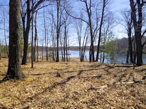
Spooner Lake (aka Crystal Brook) Fishery Area
DNR Fisheries Areas
Spooner Lake (aka Crystal Brook) fishery area was originally purchased in 1963 with the intent of protecting spawning habitat on Spooner Lake. It has a mix of stands of oak, aspen and marsh and has known archaeological sites nearby.
Location/Directions
The fishery area is located approximately 7.5 miles northeast of Spooner. From state highway 70, travel north on U.S. Highway 63 approximately 3 miles and merge on U.S. Hwy 53. Travel .4 miles and turn east on county highway A. Travel 2 miles and turn south on Mann Road. Travel an additional 2.1 miles and arrive at the parking area near the Spooner Lake boat access. Access to the property is best obtained by boat, canoe or kayak from Spooner Lake.
Activities
Recreational Opportunities
|
|
Objective
The main objective is to protect spawning habitat on Spooner Lake. The Spooner Lake (aka Crystal Brook) fishery area is managed for upland habitat for wildlife, timber and compatible outdoor recreational opportunities. Timber sales have been used as the primary habitat management tool.
Contacts/Partners
For questions and comments contact:
Property Manager
Department of Natural Resources
810 W Maple Street
Spooner WI 54801
715-635-4022
Fisheries Biologist
Department of Natural Resources
810 W Maple Street
Spooner WI 54801
715-635-4095

