Groundwater quantity
GCC Report to the Legislature
Groundwater is abundant in Wisconsin and available in sufficient amounts throughout most of the state. Groundwater provides adequate water supplies for most municipal, industrial, agricultural and domestic uses. However, groundwater pumping can lower water levels in an aquifer and in certain settings reduce groundwater discharge to surface water bodies connected to the aquifer. In parts of the state groundwater availability is limited due to natural aquifer limits or extensive use of supplies.
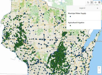
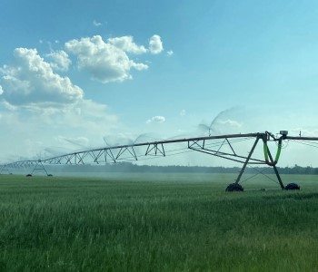
Water useThe Water Use StoryMap showed that the largest category of groundwater withdrawals was municipal public water supplies. The second largest category of groundwater withdrawal in the state was agricultural irrigation. Agricultural irrigation water use varies from year to year depending on the timing of rainfall during the growing season. » Read more. |
Water quantity monitoringwater levels based on groundwater availability. / Photo Credit: Wisconsin DNR In many areas of the state, groundwater and surface water are well connected, requiring a better understanding of the role water withdrawals have on streamflow and lake water levels. The Water Use Monitoring StoryMap explains how we gather the necessary information to understand how groundwater and surface water are connected. » Read more. |
Water use research and management toolsWisconsin DNR. Water use research informs Wisconsin’s water quantity management program. Research projects improve our understanding and management of water quantity issues in different parts of Wisconsin. » Read more. |
Regional drawdownsSeveral areas of Wisconsin have seen regional drawdowns of the groundwater due to extensive groundwater withdrawals. These drawdowns can affect water availability and water quality. » Read more. |
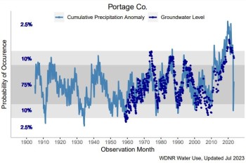
Groundwater level fluctuationsaverage in Portage County shows above-average precipitation in recent years, returning to average precipitation, with declining, but still above average groundwater levels. DNR staff track recent and historical precipitation and compare that data to long-term averages to characterize and identify trends. We compare these precipitation patterns to water level readings in monitoring wells around the state. Groundwater levels were at or near all-time highs in 2020 and 2021. Since 2021, groundwater levels have started to decline following a period of more typical precipitation amounts (2022) to below-average precipitation amounts (spring, early summer 2023). » Read more. |
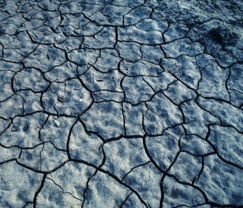
2023 DroughtAfter a wet spring in 2023, Wisconsin experienced a flash drought that lasted until April 2024. While temperatures remained relatively cool, a prolonged period of little-to-no precipitation quickly created drought conditions across the majority of Wisconsin by August 2024. » Read more. |


