La Crosse, Bad Axe and Kickapoo team
Streambank Protection Program

The Kickapoo River region along with the Lower Wisconsin River and the Kinnickinnic River Regions is one of three strongholds for brown trout country in the Driftless Area. In comparison to brook trout, brown trout has a higher probability of occurrence throughout much of the planning region. Because of their more ubiquitous distribution, brown trout appear more tolerant of anthropogenic stressors. Brook trout fisheries are represented at the sub‐watershed scale because they are patchy on the landscape. Brook trout do well in the absence of brown trout and where natural habitat quality is high and anthropogenic stress is low. In terms of resilience to the effects of climate warming, the most resilient brook trout watersheds can be found in the northern and northeastern portions of the region; Lower La Crosse, Middle La Crosse, Upper La Crosse, Bear Creek, and West Fork of the Kickapoo River.
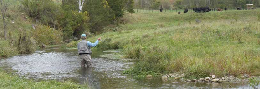
Angling opportunities in the Kickapoo Region are very good which is why this area of the state is a destination for trout anglers. There is good access in most of the watersheds and when compared to the demand, as defined by distance to population the relative supply is very good as well.
Considerations
- Most of the watersheds in the Kickapoo River Region hold a mix of brown and brook trout, but brown trout are more abundant.
- The Kickapoo River Region has the second-highest catch rates for brown trout among the eight planning regions of the Driftless Area.
- Of the 15 watersheds in the Kickapoo Region, four hold the highest densities of brown trout: the Bad Axe River, Coon Creek, Tainter Creek and the West Fork of the Kickapoo River.
- Inland waters of the region have limited smallmouth bass habitat and few smallmouth bass fisheries.
- Fishery Areas and fishing easements provide ample public access for trout angling opportunities, making this area of the state a destination for trout anglers.
- The brook trout watersheds most resilient to the effects of climate change are found in the northern and northeastern portions of the region: Lower La Crosse, Middle La Crosse, Upper La Crosse, Bear Creek, and West Fork of the Kickapoo River.
- The highest levels of land use stress on trout habitat are associated with the region’s upland ridge (Hwy 27) which runs from Norwalk in La Crosse County, southwest to Eastman in Crawford County.
- Rush Creek State Natural Area contains a diversity of habitats and is home to numerous rare plants and animals including “goat prairies,” southern oak forest, floodplain forest and the spring-fed Rush Creek itself.
- Fort McCoy offers hunting, fishing, and trapping opportunities to the general public, although a permit is required. Fort McCoy has approximately 71.2 miles of cold water streams and tributaries.
Highlighted streams
- Bishop Branch
- Seas Branch
- West Fork Kickapoo River
- Harrison Creek
- Reads Creek
- Tainter Creek
- Mill Creek
- Fancy Creek
- Knapp Creek
- Richland Creek
Partners
- TU – Coulee Chapter
- Driftless Area Land Conservancy
- North Central WI Land Conservation Departments
- Natural Resources Conservation Service
- Arcadia Rod & Gun Club
- Alma Rod & Gun Club
- Durand Rod & Gun Club
Accomplishments
The La Crosse/Bad Axe/Kickapoo Team and their conservation partners have worked to acquire stream bank easements directly from landowners within their region. These easements provide public access to high-quality trout streams and allow the DNR to manage these stream corridors to increase the health of the trout fishery for today and future generations.
From July 2014 to June 15, 2016, the La Crosse/Bad Axe/Kickapoo Team worked with property owners to purchase 7 easements in 6 sub-watersheds. These transactions resulted in a total of 35.25 easement acres encompassing 13,498 stream feet (2.56 miles) at a cost of $109,728; an average of $3,112 per easement acre or $8.13 per stream foot.
